A Video Overview of Using Geospatial Information Systems (GIS) to Enhance Citizen Participation
This video provides an overview of Professor Ganapati's report on the evolution of the use of Geographic Information Systems (GIS) in government, with a focus on the use of GIS by local government.
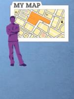
The current third wave (Geospatial Web 2.0 platforms) has seen a dramatic increase in the use of GIS by citizens, such as obtaining transit and crime information. Professor Ganapati presents several case examples of how GIS is now being used by local governments across the nation. Of special interest to Professor Ganapati is the potential use of GIS in reaching out to citizens to increase their participation in planning and decisionmaking. He concludes that, while progress has been slow in this area, there is great potential for government and other groups to use GIS to increase citizen participation.
1 comments
Business of Government: bravo! your organization produces valuable research in so many fields, yet program managers do not have or take the time to take advantage of your efforts. this video format may be the medium that gets this information into the right hands... and minds!